Nuevo artículo: The naïve map of the sixteenth century roads in Spain
Federico Pablo-Martí, de la Universidad de Alcalá, y Gustavo Romanillos de tGIS publican artículo en el que reconstruyen la red de caminos de la España peninsular del siglo XVI
23 jul 2023 - 13:37 CET
Resumen / Abstract:
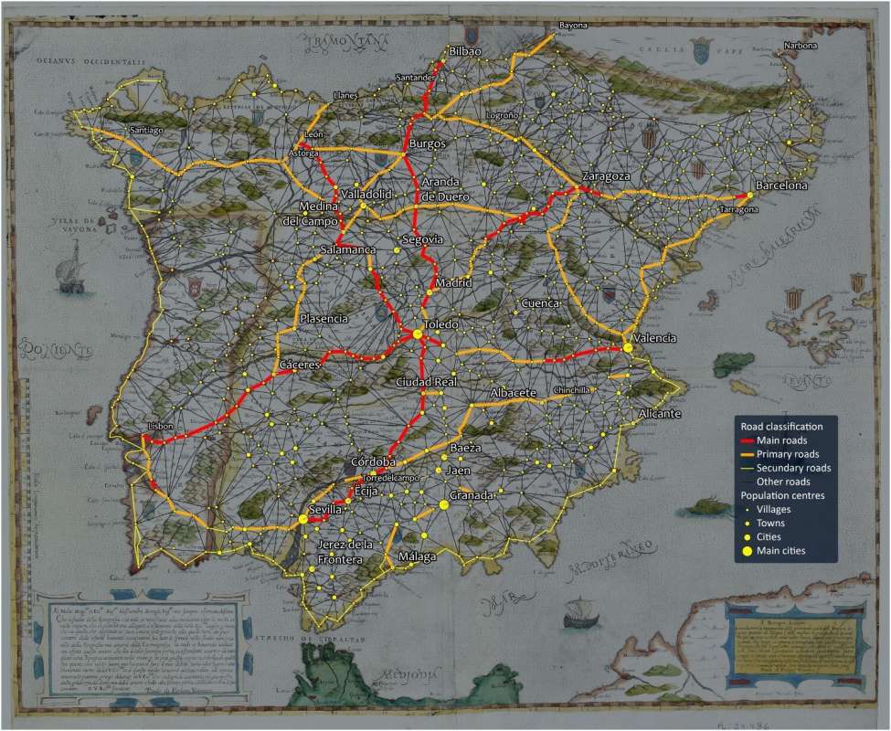
This paper presents a naïve map that attempts to reflect the vision that Philip II and his advisorsprobably had of the Spanish road network in the second half of the sixteenth century, a crucialaspect for the choice of the seat of the capital of the kingdom. The elaboration of the naïvemap was carried out in two phases: in thefirst, the road network was reconstructed basedon a thorough revision of the primary sources that have survived to the present day. Asthese sources showed evident problems of completeness, the network was completed usingmathematical methods, which were statistically contrasted. The analysis carried out is animportant novelty since it shows that most of the transport in the Iberian Peninsula waschanneled through the center following a radial structure with six principal axes twocenturies before what has been traditionally considered.
Enlace: https://www.tandfonline.com/doi/full/10.1080/17445647.2023.2232360