Nuevo artículo: Beyond land use mix, walkable trips. An approach based on parcel-level land use data and network analysis
Jose Carpio-Pinedo parte del equipo de TGIS firma este artículo de la revista Journal of Maps
1 feb 2021 - 10:50 CET
Artículo en: https://www.tandfonline.com/doi/full/10.1080/17445647.2021.1875063
Resumen
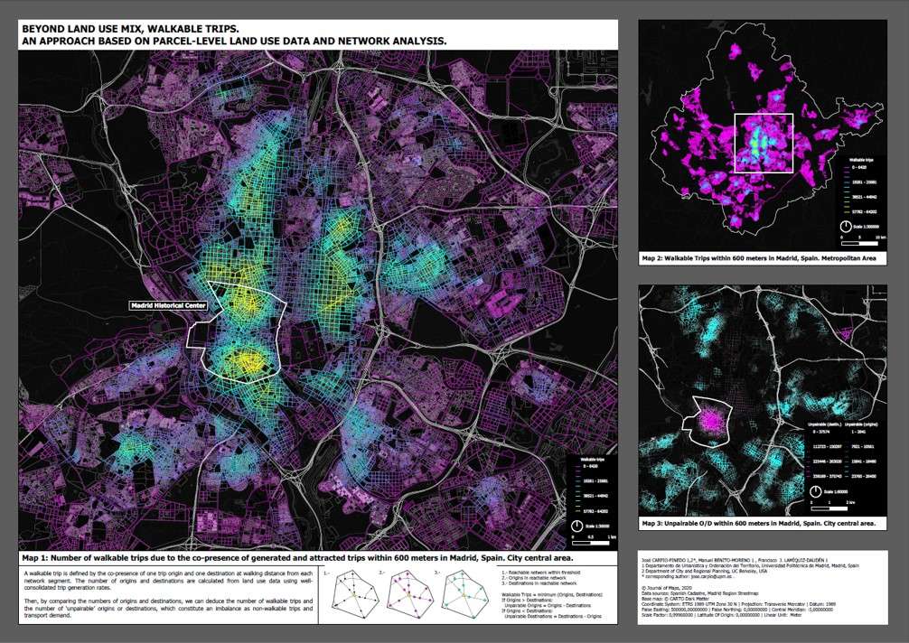
Land use mix is one of the cornerstones for urban sustainability, in opposition to functional segregation and zoning policies. Land use mix is a prerequisite for urban proximity dynamics, healthier lifestyles and public space vitality. However, methodological shortcomings to its measurement remain and are responsible for the unexpected weak association with pedestrian activity. This study puts forward a novel method to reframe, measure and map land use mix as ‘walkable trips’, a closer approach to its benefits based on functional and spatial complementarity. The method draws on newly available cadastral microdata at the parcel-level that, combined with trip generation rates and network analysis tools, enable a detailed assessment and mapping of potential for walkable trips, as well as a proxy to the spatial patterns of urban vitality, in line with the principle of the 15-minute city. The method is applied to the case of the Madrid metropolitan area.