Nuevo artículo: Using geotagged photographs and GPS tracks from social networks to analyse visitor behaviour in national parks
21 may 2019 - 10:36 CET
Barros, C., Moya-Gómez, B., and Gutiérrez, J. (2019). Using geotagged photographs and GPS tracks from social networks to analyse visitor behaviour in national parks. Current Issues in Tourism. (DOI: 10.1080/13683500.2019.1619674)[JCR Impact factor 2017: 2.330, Q1].
Abstract
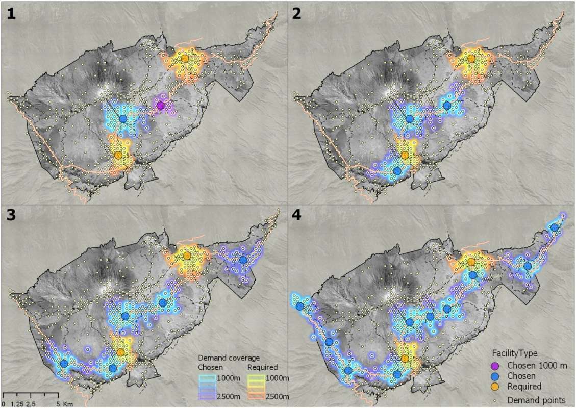
This article explores the potential of geotagged data from social networks to analyse visitors’ behaviour in national parks, taking the Teide National Park as a study area. Given its unique landscape and characteristics, plus the fact that it is the most visited national park in Spain, Teide National Park presents itself as a suitable candidate to explore new sources of data for studying visitors’ behaviour in national parks. Through data from a social photo-sharing website (Flickr) and GPS tracks from a web platform (Wikiloc), we outline several visitors’ characteristics such as the spatial distribution of visitors, the points of interest with the most visits, itinerary network, temporal distribution and visitors’ country of origin. Additionally, we propose a practical use of geotagged data for determining optimal locations for new facilities such as information stands. Results show that data from social networks is suitable to analyse visitor behaviour in protected areas.
Galería Imágenes